Key Enhancements
This release of TitleFlex® delivers the below two key enhancements.
• Terrain Map• Rapid Legal & Vesting Enhancements
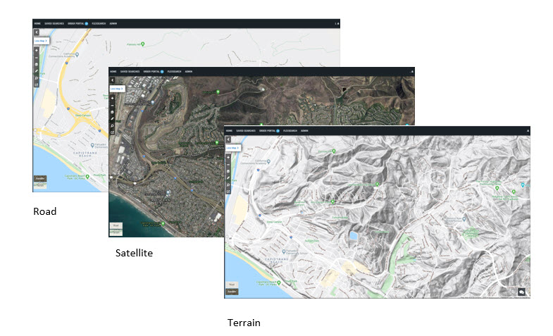
Google Terrain Map
TitleFlex has added a Google Terrain map which shows the 3D elevation of geographic features such as mountains and valleys. All existing map layers such as parcel lines, owner information, listing/sold flags, flood and more have been incorporated into the map. Users can toggle between the Terrain, Road and Satellite maps.
Topographic contour lines overlaid on the map help you identify the height and shape of natural features such as hills and canyons, and include elevation levels and altitude. This information can be useful in identifying areas at risk for flooding or susceptible to erosion.
-
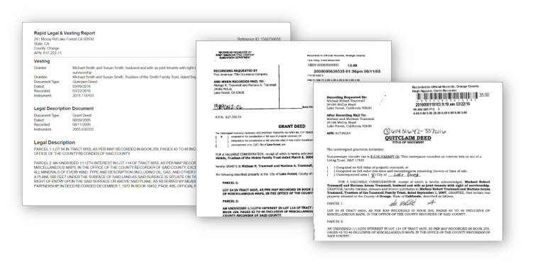
Rapid Legal & Vesting Enhancements
- TitleFlex’s Rapid Legal and Vesting has been enhanced so the legal description will always come from a property's last full value transfer. Often the last full value transfer comes from an insured transaction, unlike a quitclaim deed. We believe this is the most accurate legal description and we will no longer provide legal descriptions from quitclaim deeds.
We will continue to provide you the vesting information from the most recent deed whether it’s a quitclaim deed, full value transfer or other.-
For additional information on this release, please contact the DataTrace Customer Success team at 800.221.2056 or DTraceCS.sna.ca@firstam.com .